INTRODUCTION
In recent years, the world of agriculture has witnessed a groundbreaking transformation through the integration of satellite imagery technology. This innovation has not only enhanced the productivity and efficiency of farming but has also contributed significantly to sustainable agricultural practices. In this article, we will explore the various facets of satellite imagery agricultural technology and its profound impact on the agricultural sector.
THE BASICS OF SATELLITE IMAGERY
Understanding Satellite Imagery
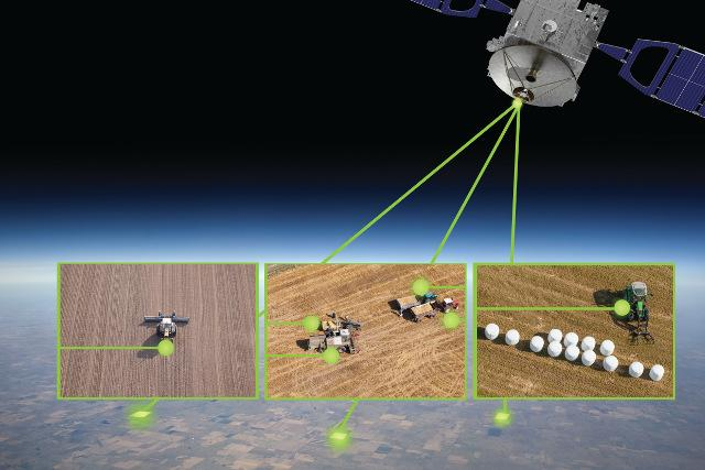
Satellite imagery, in essence, refers to the capture of visual data and information about the Earth’s surface using satellites orbiting our planet. These satellites are equipped with advanced sensors and cameras that capture high-resolution images, offering a unique perspective of our planet from above.
Utilizing Satellite Technology
Satellite imagery technology is extensively used for a multitude of purposes, including weather forecasting, environmental monitoring, disaster management, and, most importantly, agriculture. It provides invaluable insights into various aspects of farming, making it an indispensable tool for modern-day farmers.
REVOLUTIONIZING FARMING PRACTICES
Precision Agriculture
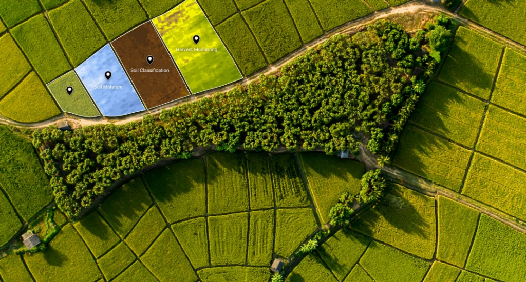
One of the key advantages of satellite imagery in agriculture is its contribution to precision agriculture. Farmers can now analyze their fields at a granular level, allowing for precise decisions regarding crop management, irrigation, and fertilization. This not only maximizes yields but also minimizes resource wastage.
Crop Health Monitoring
Satellite imagery enables farmers to monitor the health of their crops remotely. By analyzing spectral data, farmers can detect early signs of stress, disease, or nutrient deficiencies, enabling them to take timely corrective actions.
SUSTAINABILITY AND ENVIRONMENTAL IMPACT
Reduced Chemical Usage
Satellite technology empowers farmers to apply pesticides and fertilizers only where needed, reducing the overall usage of chemicals. This not only saves costs but also minimizes the environmental impact of farming.
Water Management
Efficient water management is crucial in agriculture. Satellite imagery helps in identifying areas of excessive water usage and assists in optimizing irrigation practices, conserving water resources.
CHALLENGES AND FUTURE DEVELOPMENTS
Cost and Accessibility
While satellite imagery technology offers numerous benefits, it is not without challenges. The cost of accessing high-quality satellite data can be a barrier for small-scale farmers. However, advancements in technology and increasing competition are gradually making it more accessible.
Integration of Artificial Intelligence
The future of satellite imagery technology in agriculture lies in the integration of artificial intelligence (AI). AI algorithms can analyze vast amounts of data from satellite images to provide real-time recommendations to farmers, further enhancing efficiency and productivity.
CONCLUSION
Satellite imagery agricultural technology has ushered in a new era of farming, characterized by precision, sustainability, and efficiency. By harnessing the power of satellite data, farmers can make informed decisions that positively impact their yields, reduce costs, and contribute to a more sustainable future for agriculture.